Journey Along the Trans Canada Trail
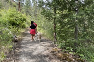
The Trans Canada Trail stretches an impressive 27,000 kilometres, making it one of the longest networks of its kind in the world. Spanning from Newfoundland to Vancouver Island and reaching north from Alberta to the Arctic Ocean, this national trail offers a unique cross-section of Canada’s diverse landscapes. In Summerland, the local Trans Canada Trail Society meticulously maintains 61.5 kilometres of this trail, running from Penticton to just east of Osprey Lake. This segment allows for a rich exploration of local flora and fauna beneath the shelter of Ponderosa pines, through vibrant wildflowers and past the panoramic views of valley farmlands.
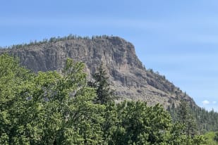
From Conkle Mountain to Trout Creek Canyon
The journey begins at Conkle Mountain Park, near the Summerland Rodeo Grounds on Bathville Road. Here, hikers and cyclists can traverse rugged unpaved and paved trail sections, witnessing nature’s grandeur firsthand. The trail heads up a gentle slope beside an operational water flume and extends through a scenic route adorned with yellow, pink, and purple wildflowers.


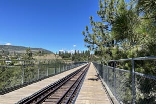
After crossing the railway line and weaving through flourishing orchards, you are led to the majestic sight of the Trout Creek Canyon and the historic train trestle that spans it. This trestle, standing at 73 metres high, marks the highest bridge span on the Kettle Valley Railway and offers breathtaking views of the surrounding canyon.
Refresh and Reflect at Summerland Sweets
After absorbing the natural beauty and historical significance of Trout Creek trestle, a short five-minute walk will bring you to Summerland Sweets. This local favourite offers shaded picnic tables where you can relax and enjoy a selection of fruit-based treats, including refreshing ice cream and fruit wines. This spot is perfect for a restful pause, allowing you to cool down and relish the products of the local land before either continuing your trek or winding down your adventure.
Access Points and Trail Features
For those looking to explore this trail, access is straightforward from the town centre: head west off Highway 97 onto Prairie Valley Road, continue to Doherty Avenue, turn right, then left at Bathville Road. This portion of the Trans Canada Trail not only highlights the beauty of Prairie Valley but also features amenities such as pit toilets, a gazebo outlook, and stunning viewpoints that make the journey as comfortable as it is captivating. Near the trail’s end at the Prairie Valley Station of the Kettle Valley Steam Railway, you’ll find additional maps and the chance to explore further into the community of Faulder or towards Osprey Lake.
Whether you’re a hiker, cyclist, or horseback rider, the Summerland section of the Trans Canada Trail offers an enriching outdoor experience, blending scenic views, historical exploration, and the serenity of nature.
You May Also Be Interested In
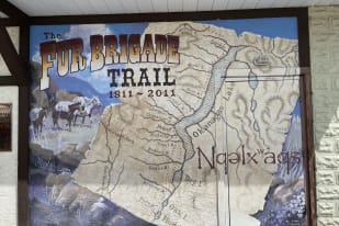
Tracing History: Journey Along The Brigade Trail in Summerland
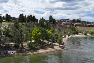
Discover the Lakeshore Loop: A Scenic Trail